PICS: Power Outage Derails India
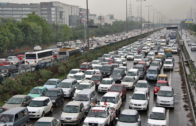
Heavy traffic moves along a busy road as it rains during a power-cut at the toll-gates at Gurgaon on the outskirts of New Delhi July 31, 2012. Grid failure hit India for a second day on Tuesday, cutting power to hundreds of millions of people in the populous northern and eastern states including the capital Delhi and major cities such as Kolkata.
 acquired August 21, 2011
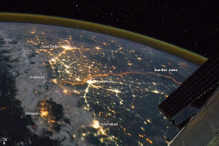
Clusters of yellow lights on the Indo-Gangetic Plain reveal numerous cities large and small in this astronaut photograph of northern India and northern Pakistan. Of the hundreds of clusters, the largest are the capital cities of Islamabad, Pakistan, and New Delhi, India. (For scale, these metropolitan areas are approximately 700 kilometers or 435 miles apart.) The lines of major highways connecting the cities also stand out. More subtle, but still visible at night, are the general outlines of the towering and partly cloud-covered Himalayas to the north (image left).
A striking feature is the line of lights, with a distinctly orange hue, snaking across the center of the image. It appears to be more continuous and brighter than most highways in the view. This is the fenced and floodlit border zone between India and Pakistan. The fence is designed to discourage smuggling and arms trafficking. A similar fenced zone separates India’s eastern border from Bangladesh (not visible).